 |
Boone County IAGenWeb
Free genealogy records |
 |
Home | What's New | Bios/Family Histories | Birth/Marr/Death | Cemeteries | Census | Directories/Lists | History | Land/Maps | Military | Photos/Postcards | Resources | Schools
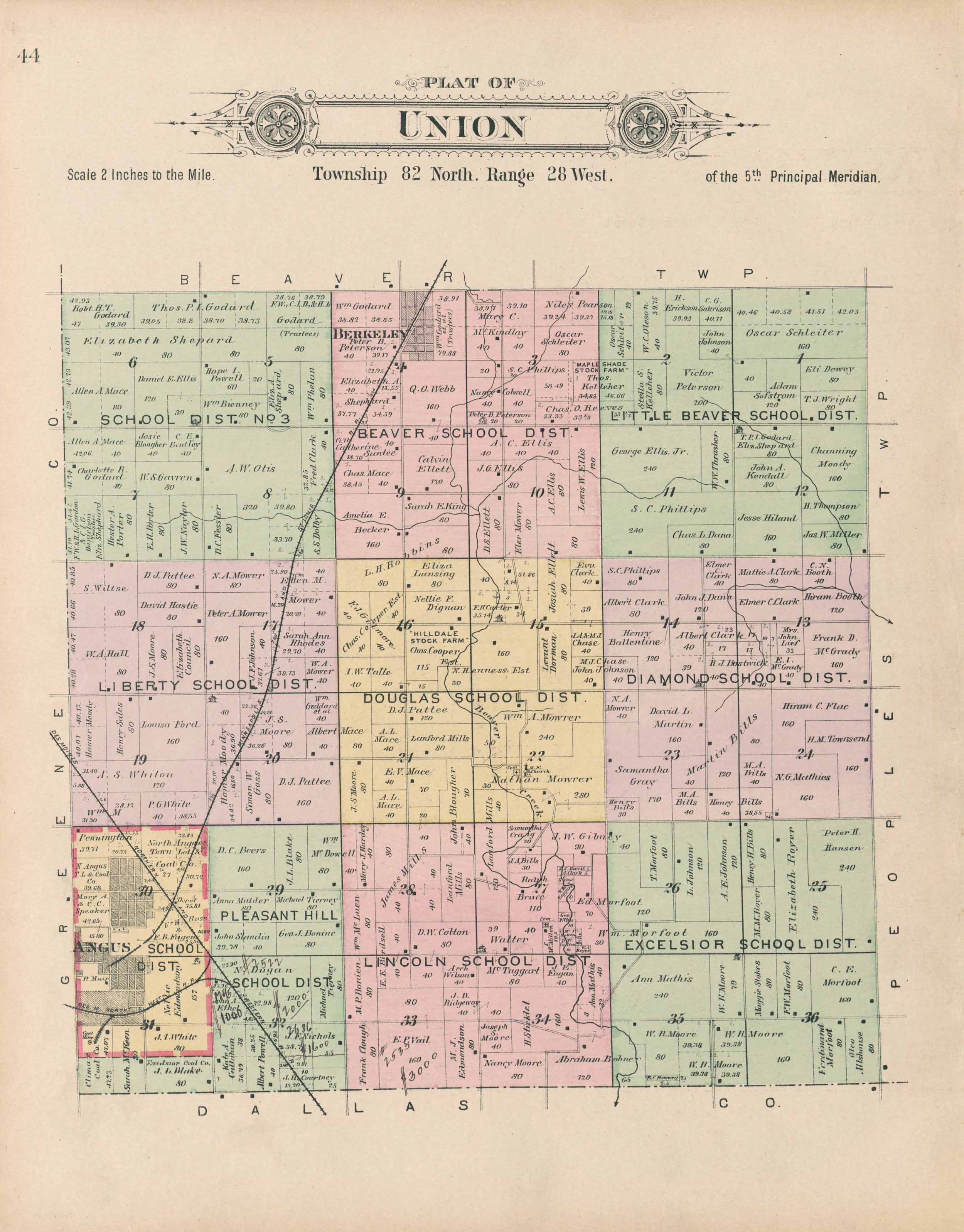
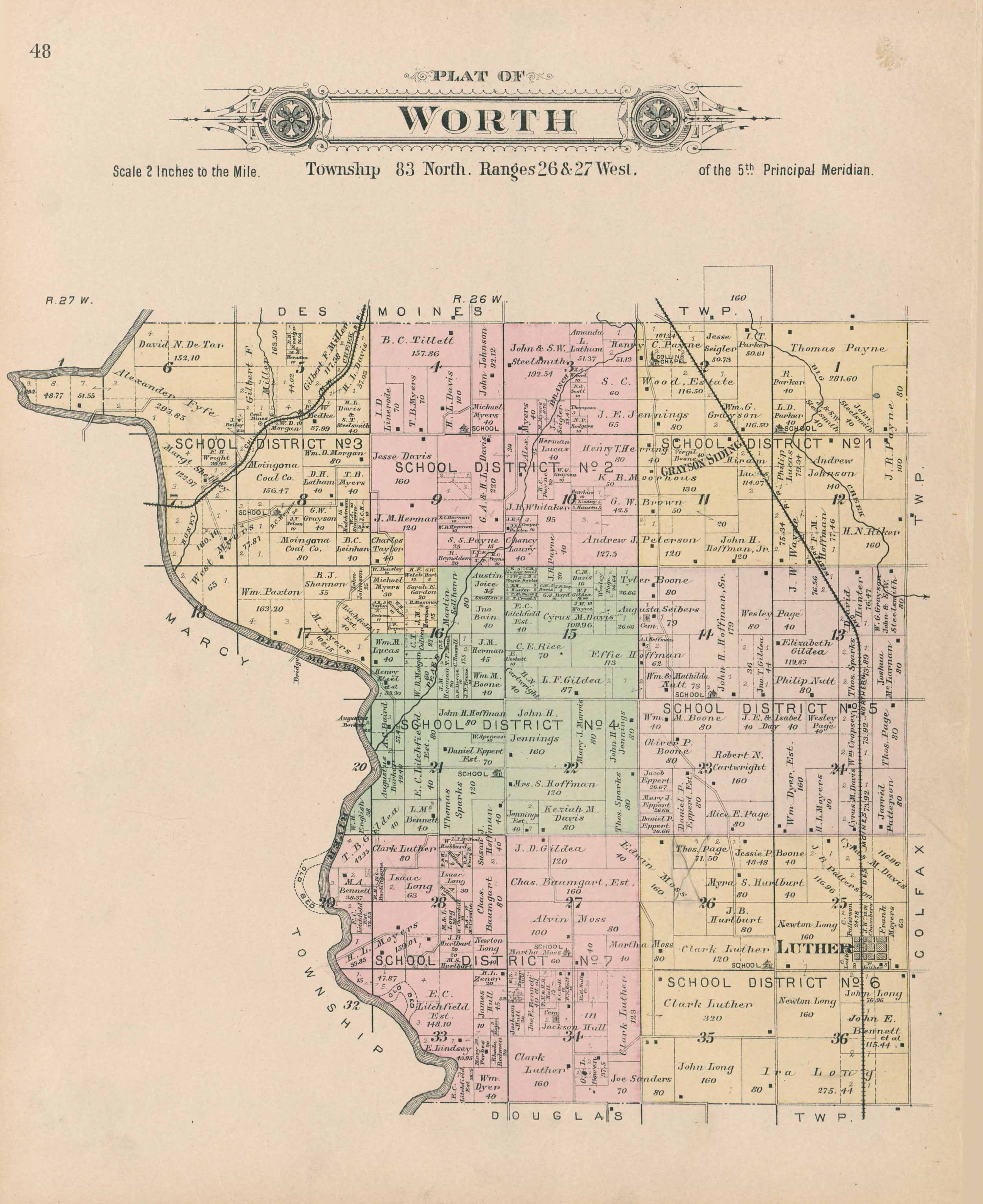
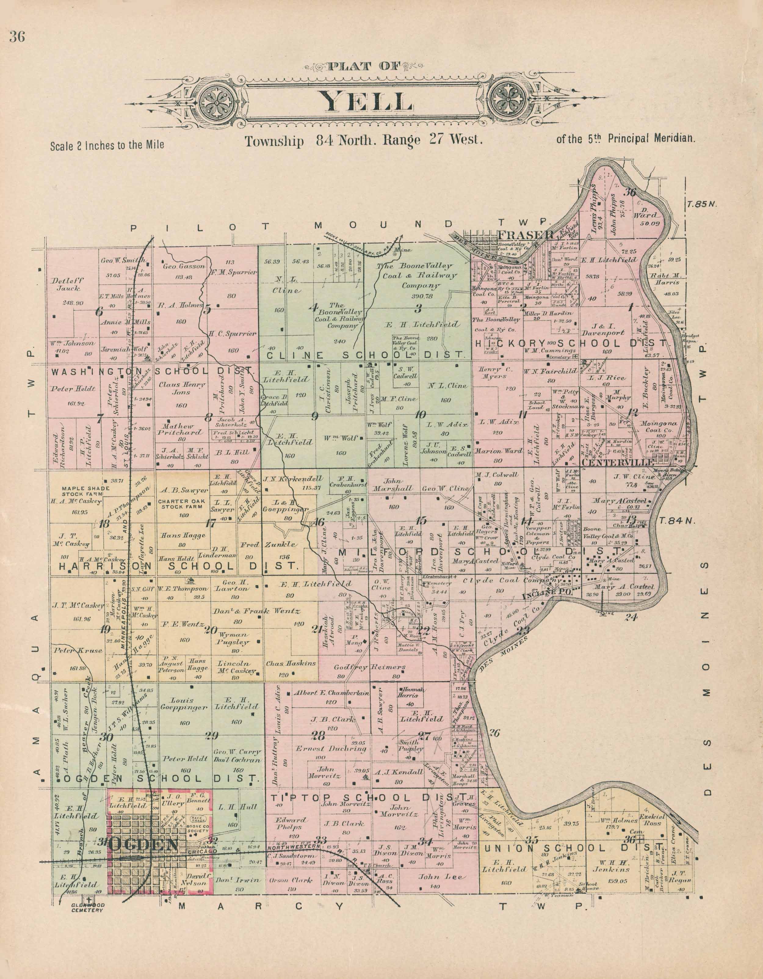
Land and Maps
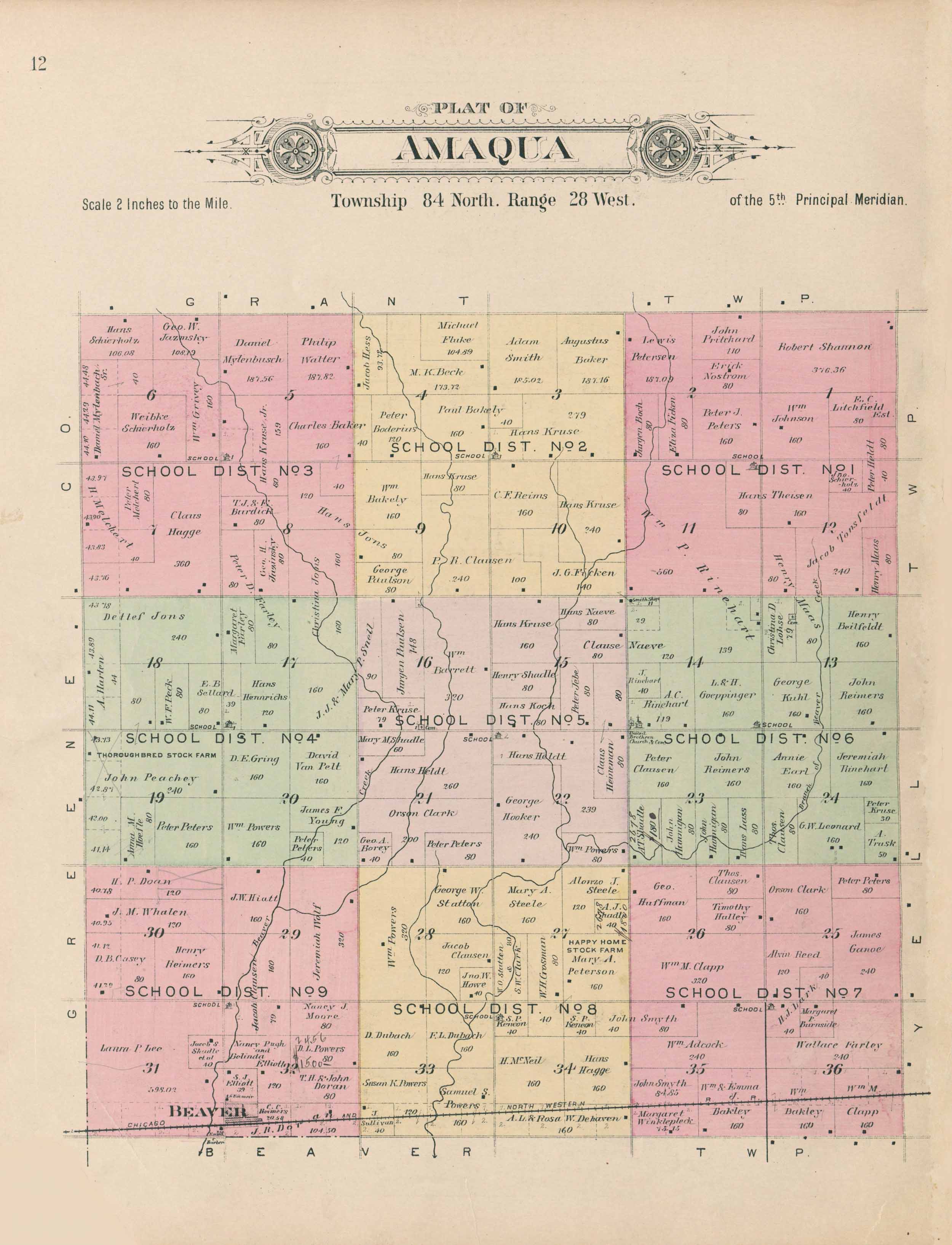
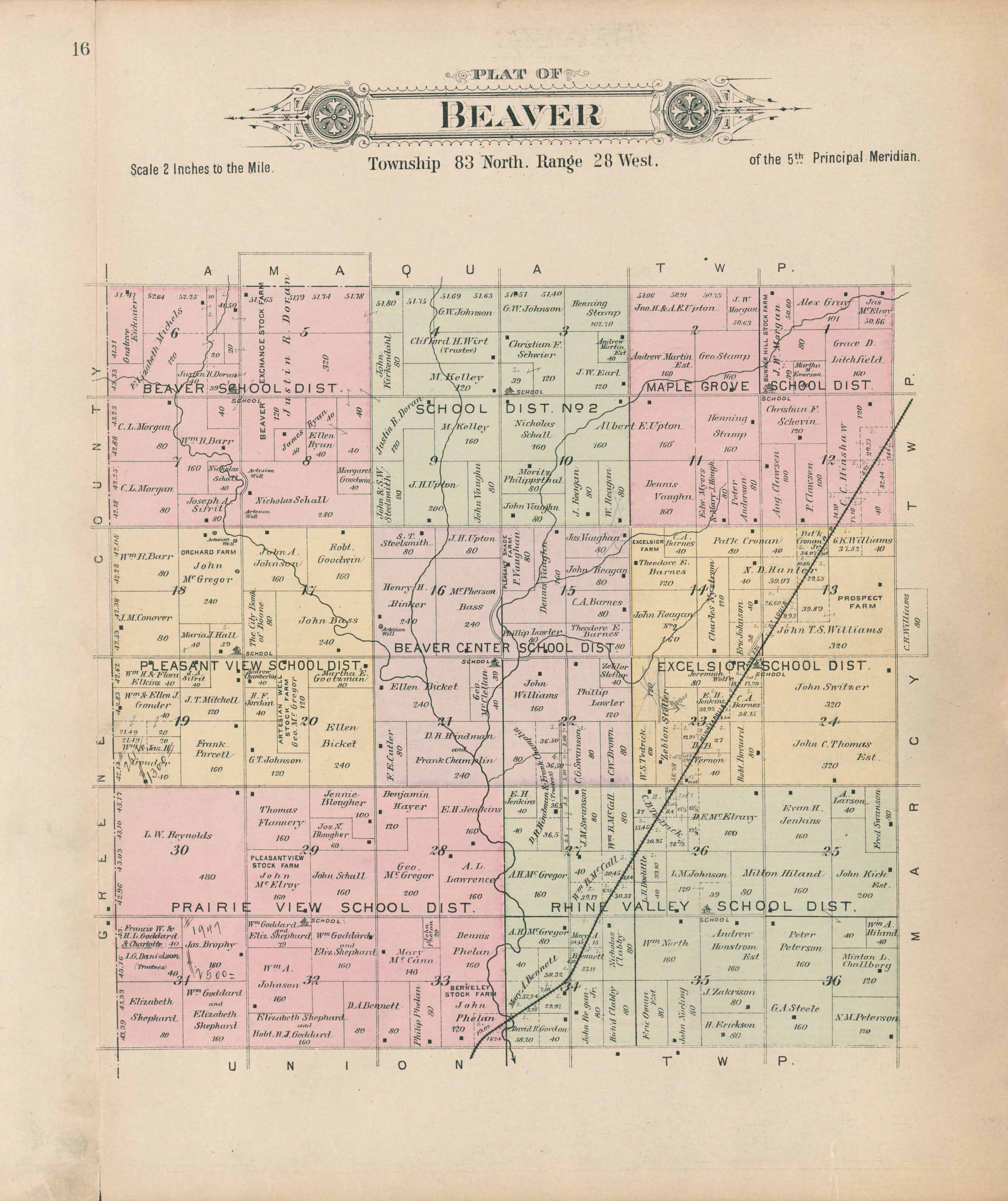
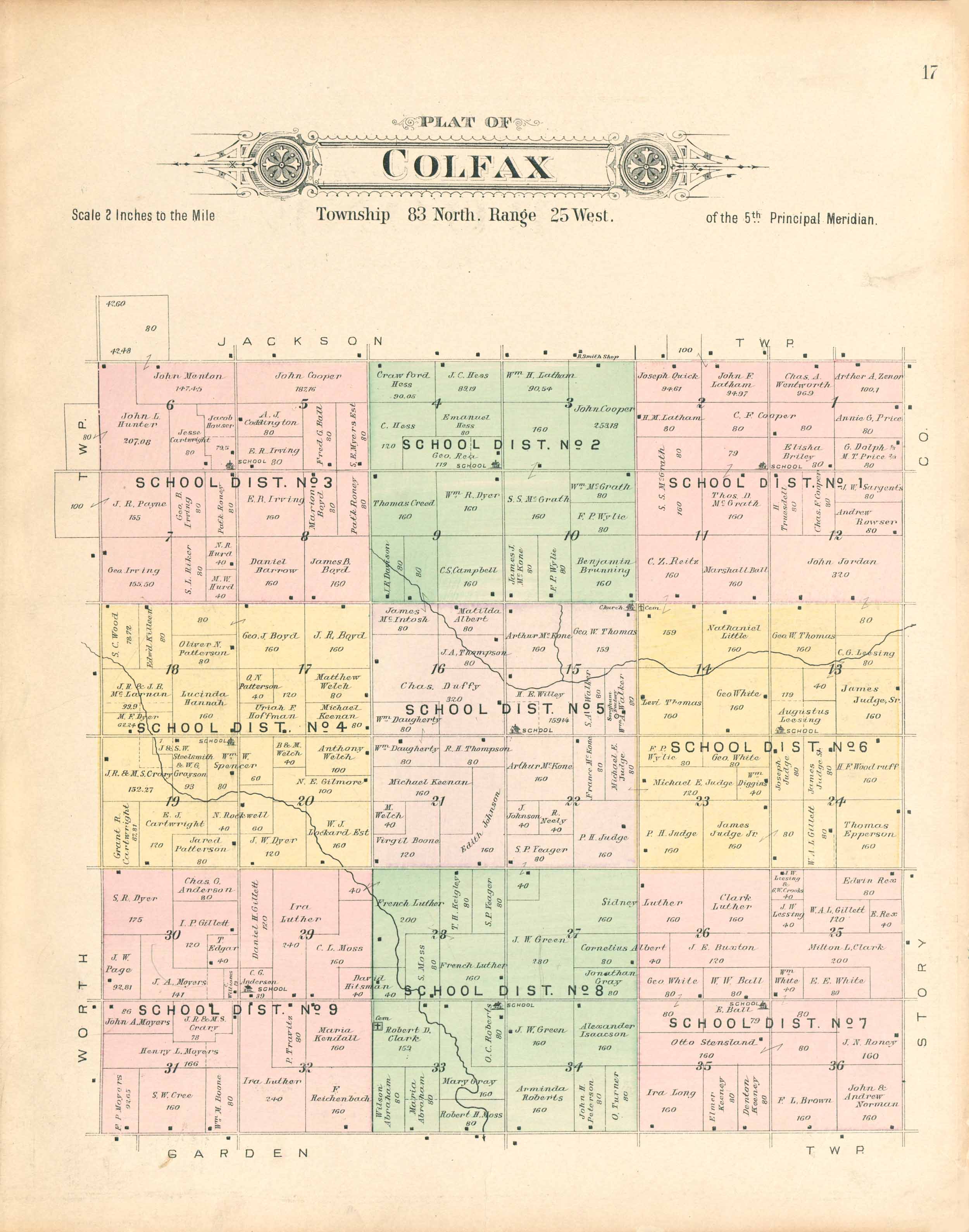
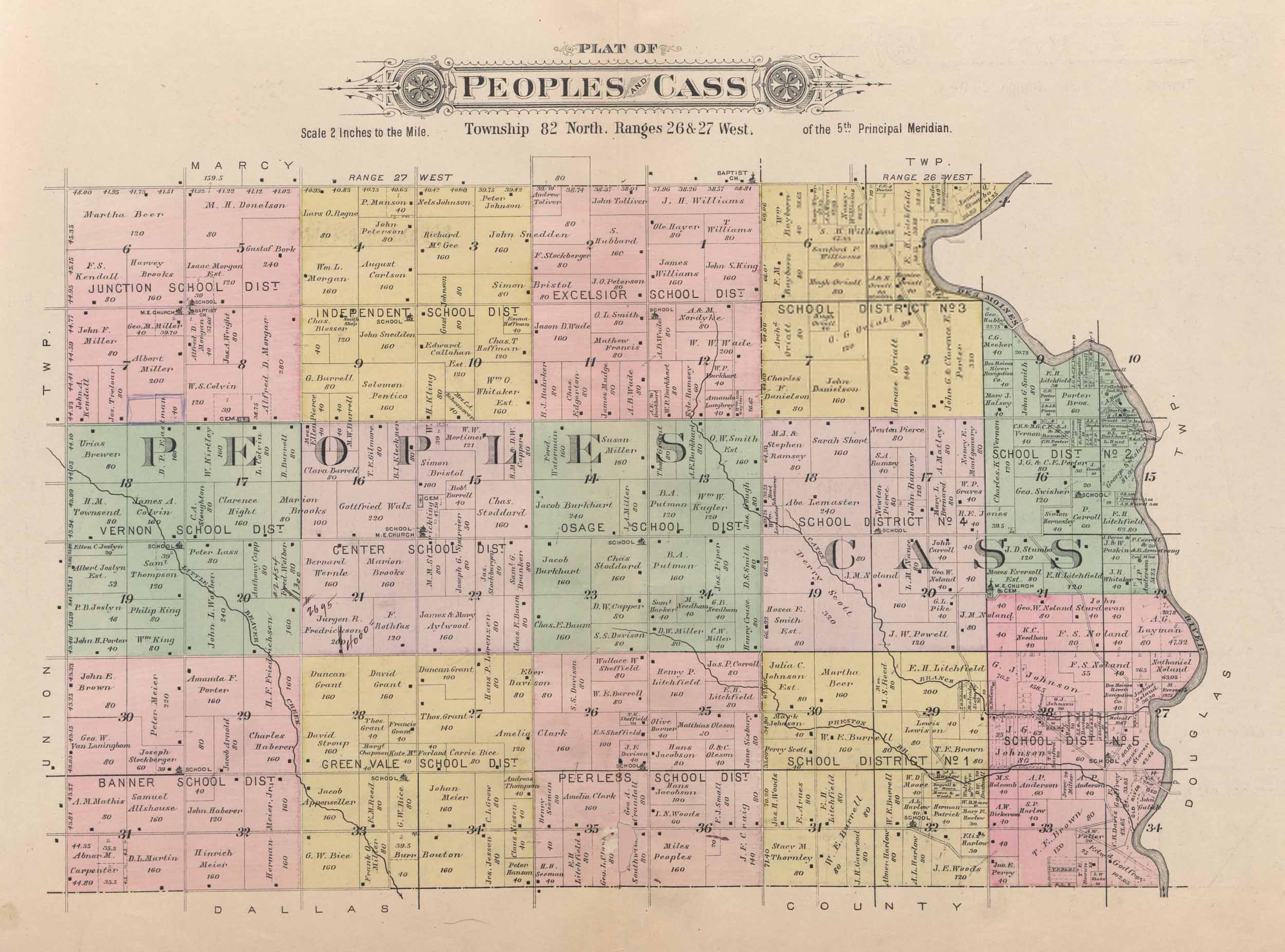
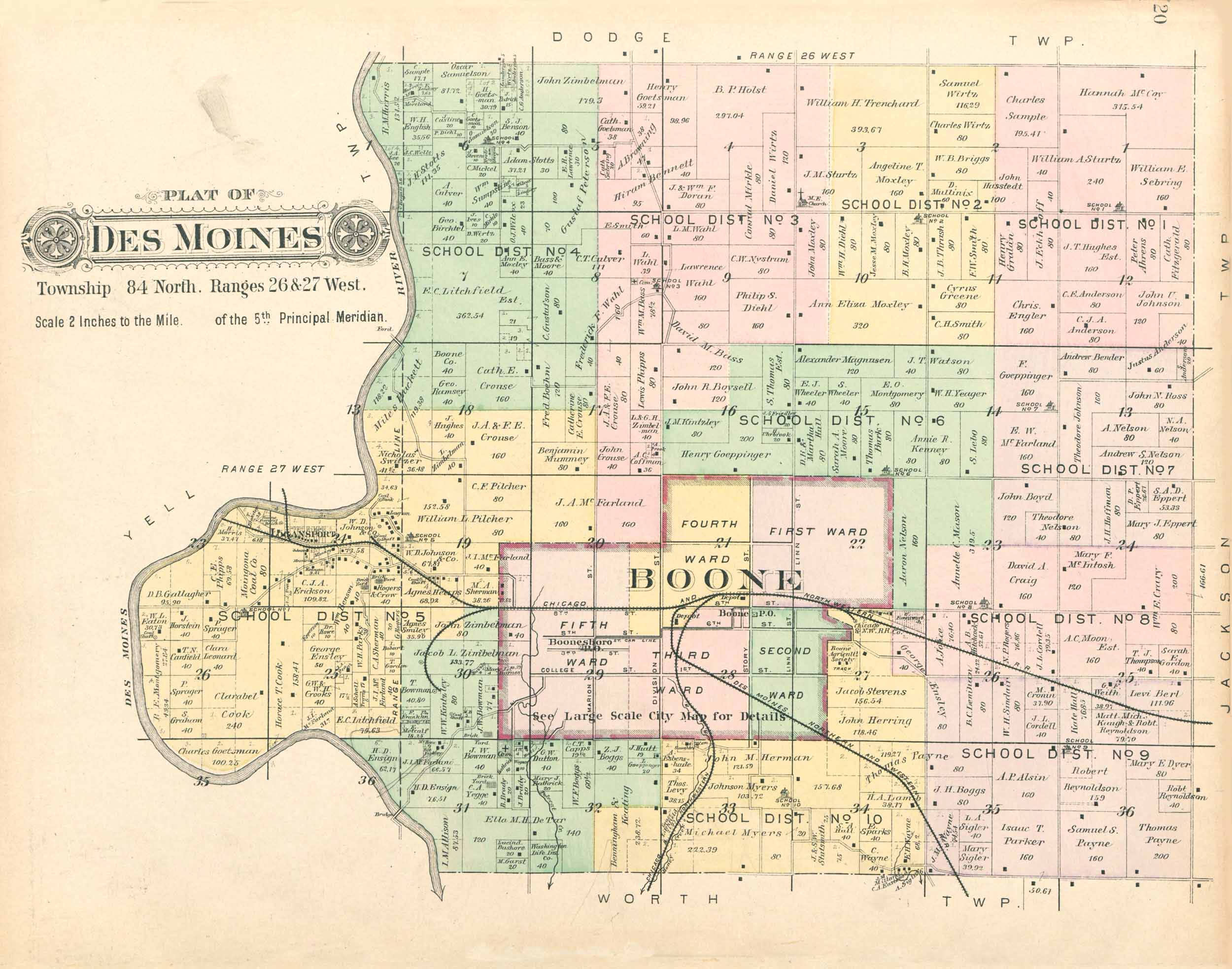
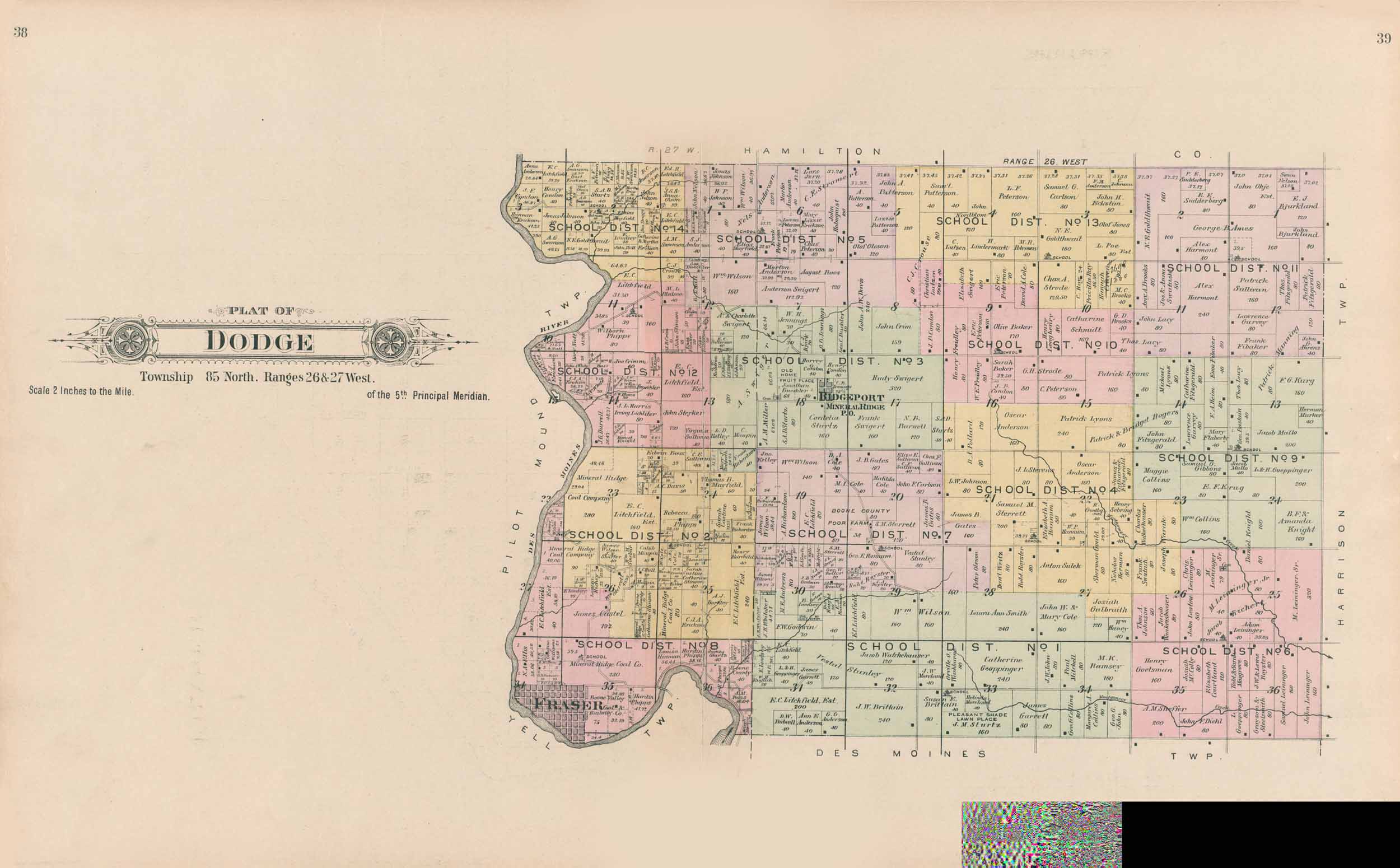
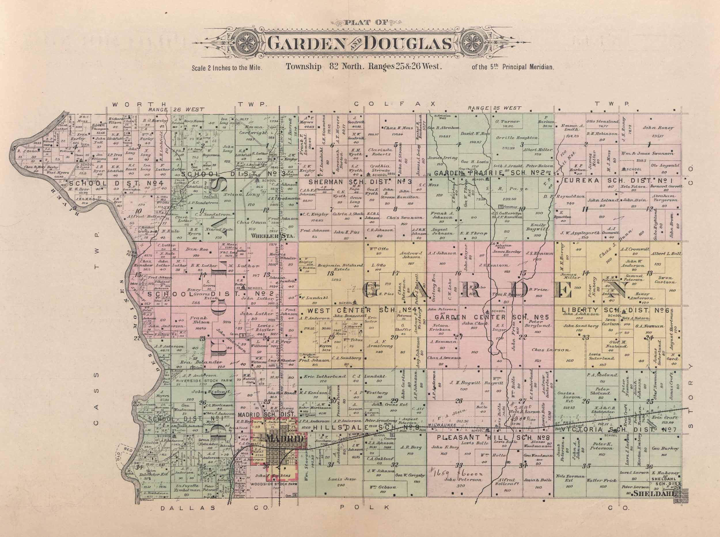
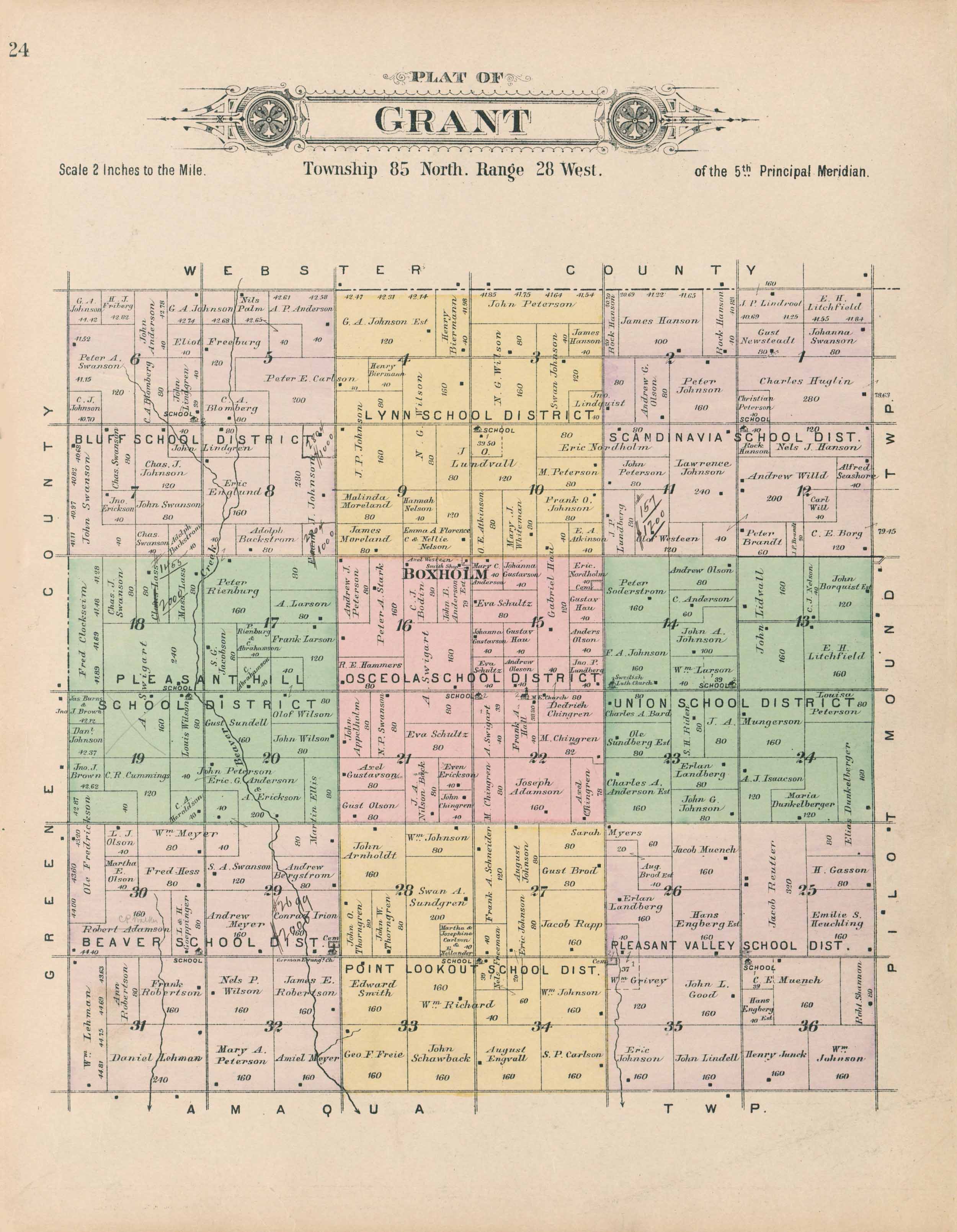
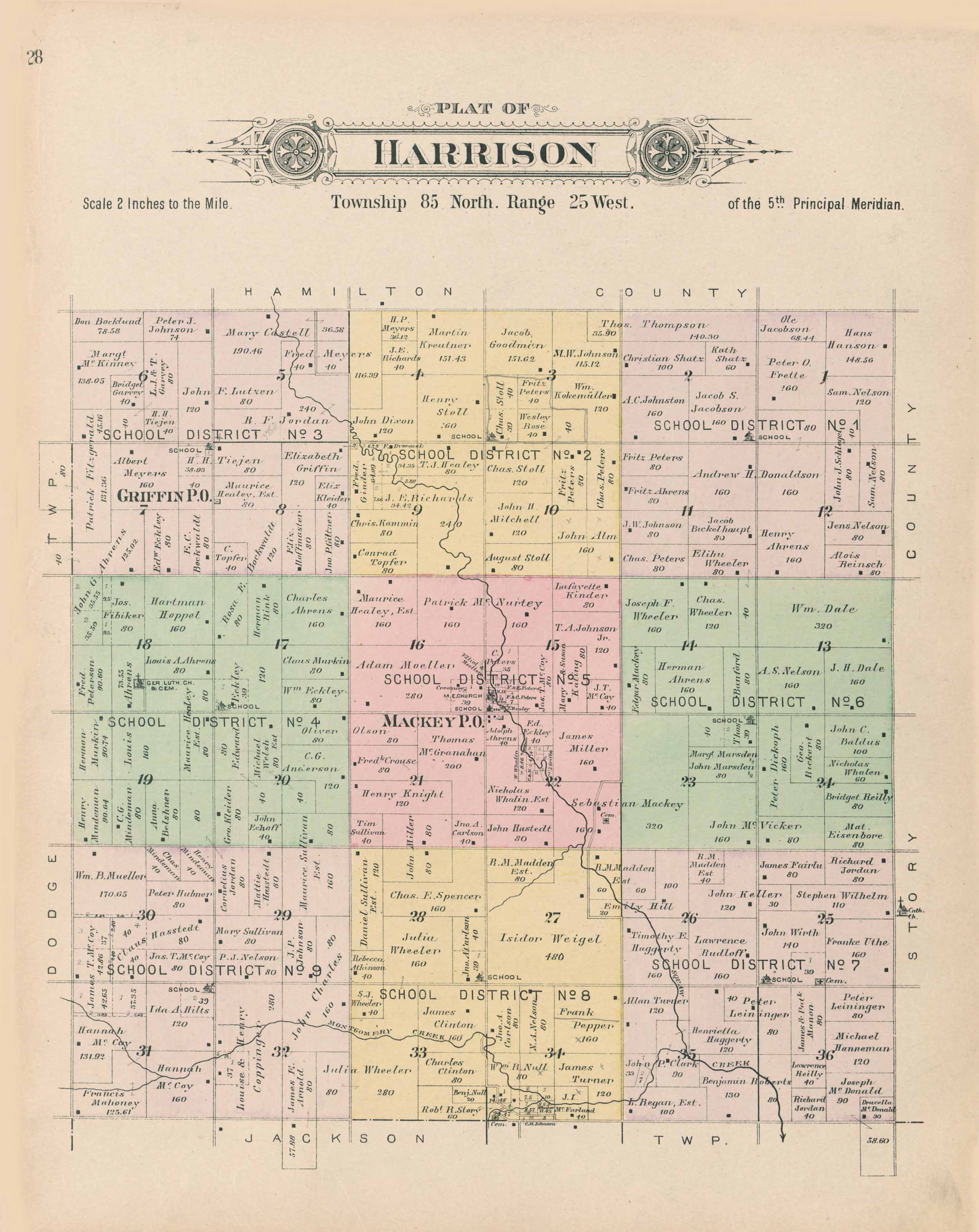
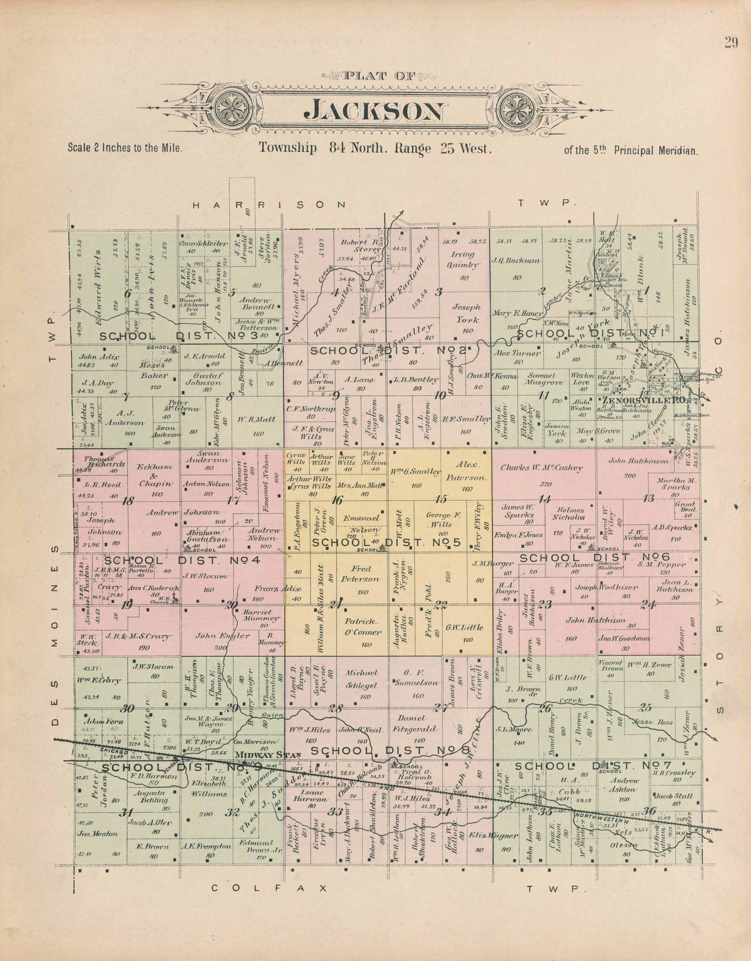
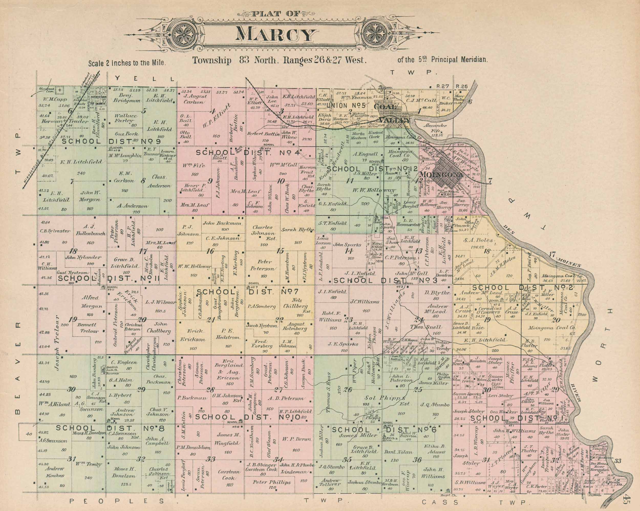
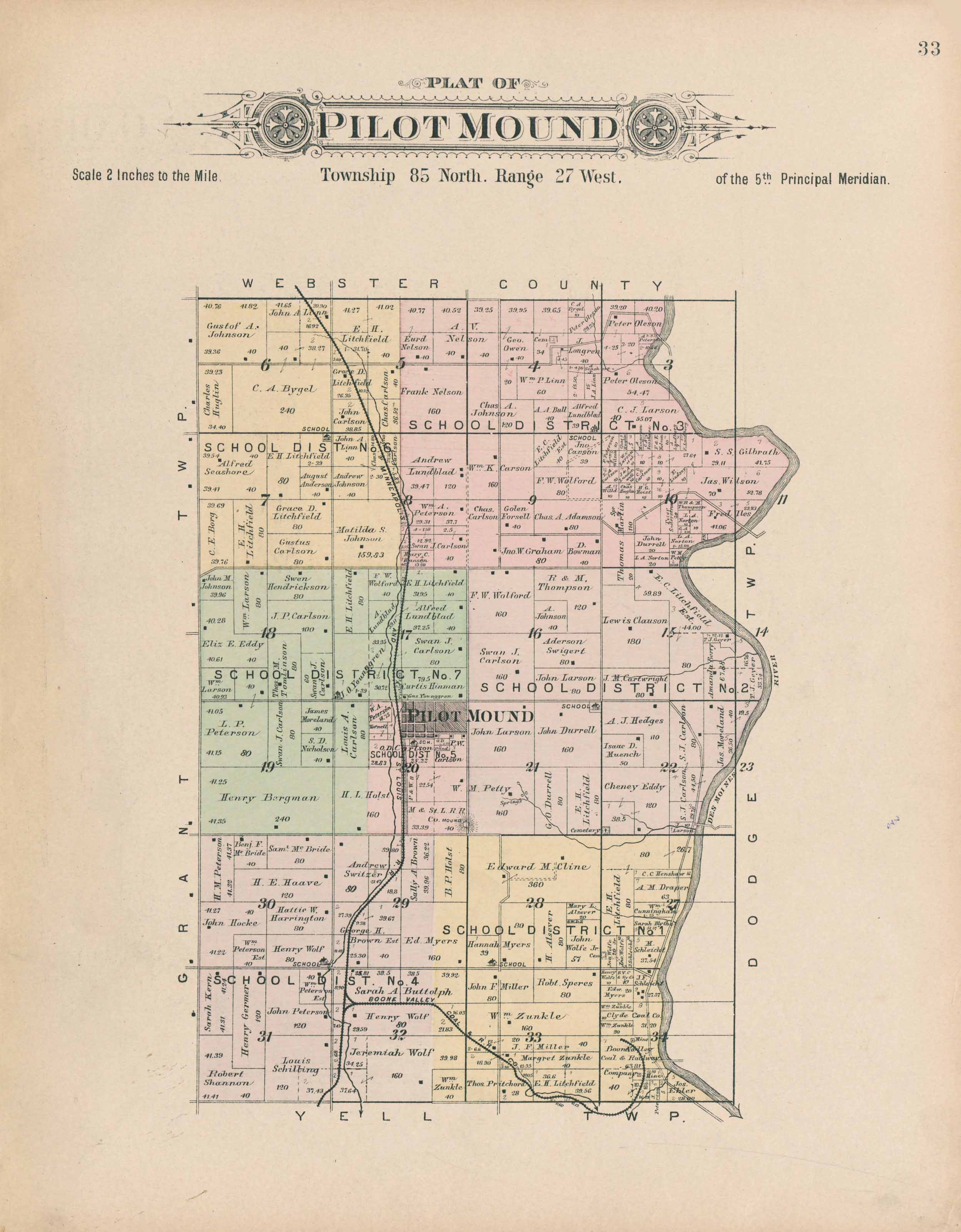
Click images to enlarge.| Maps Township Map 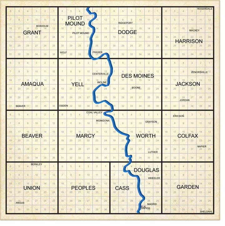  1855 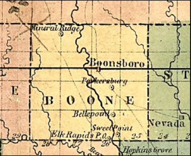 1873 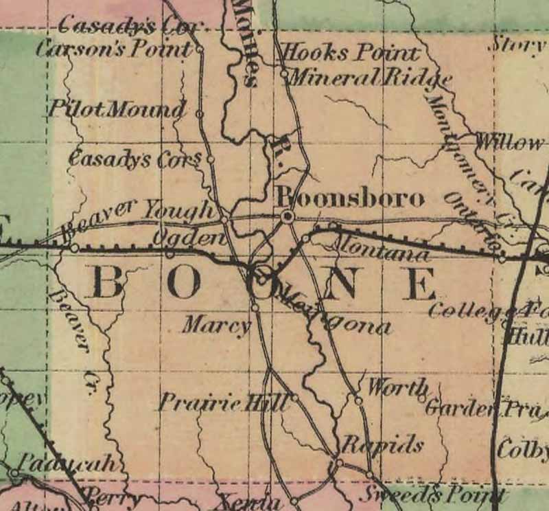 1875 Andreas Atlas Map 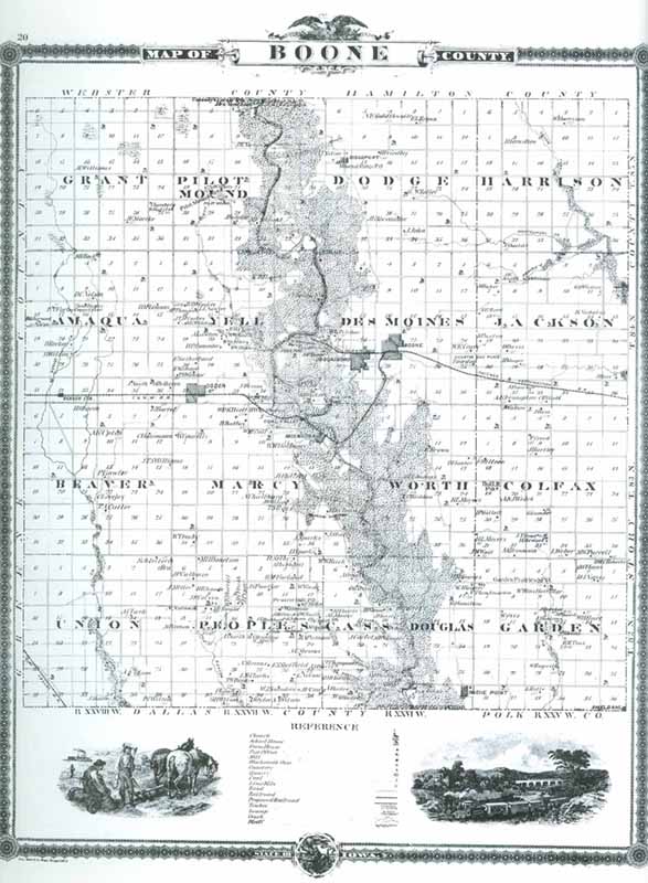 1895 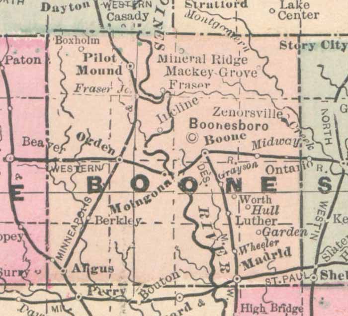 1902 Republican Atlas Outline Map 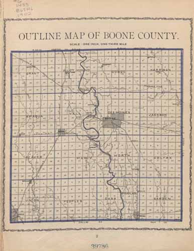 Go to the Iowa University Digital Library to see a list of plat books, plat maps/directories and atlases Historic Railroad Maps 1881 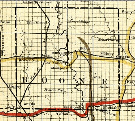 1897 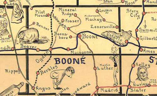 |
